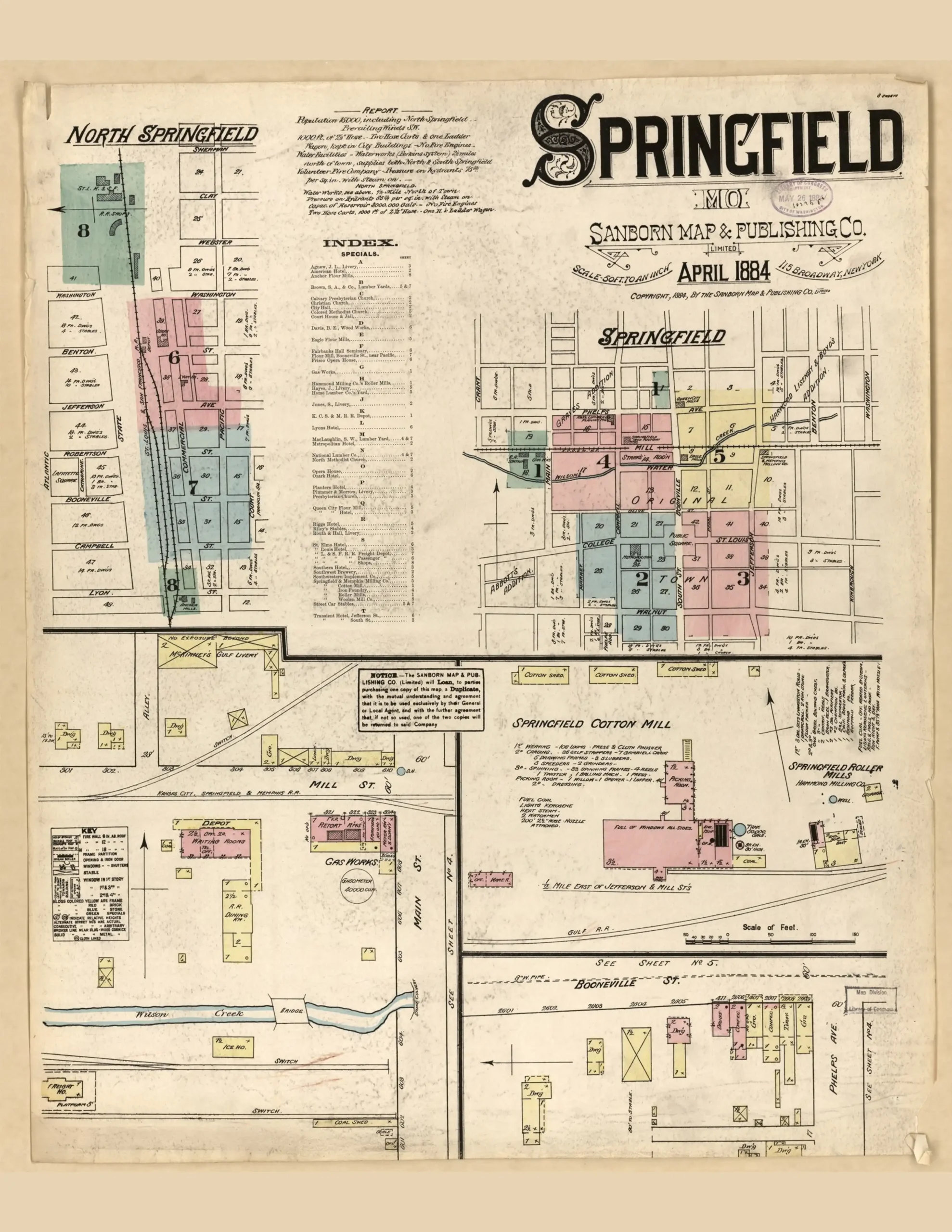
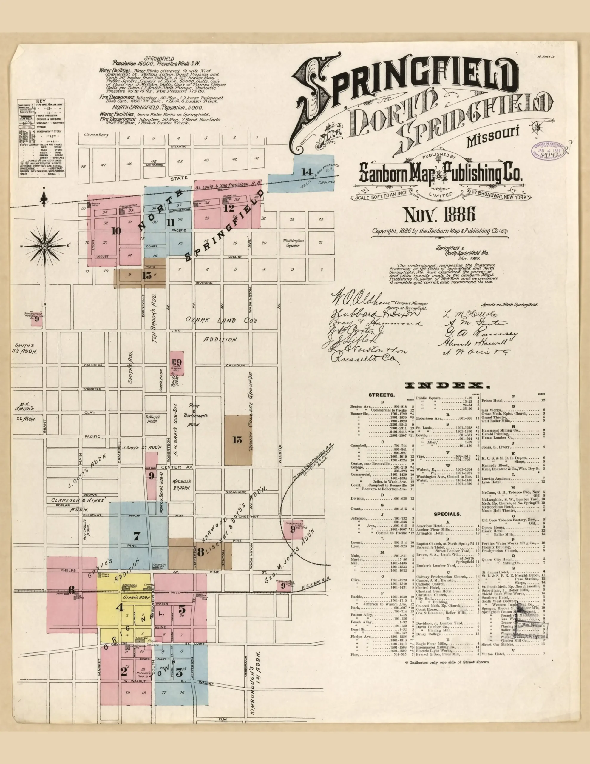
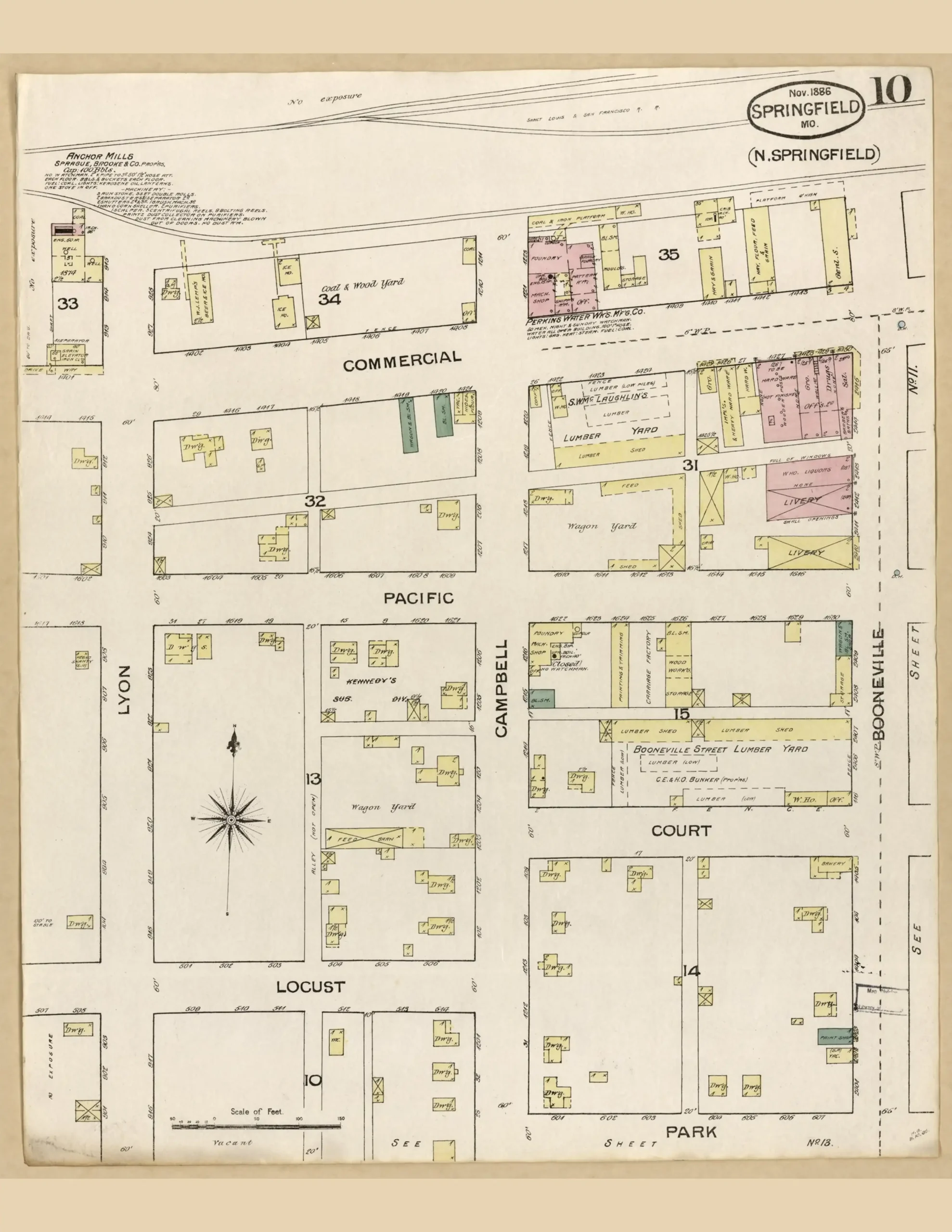
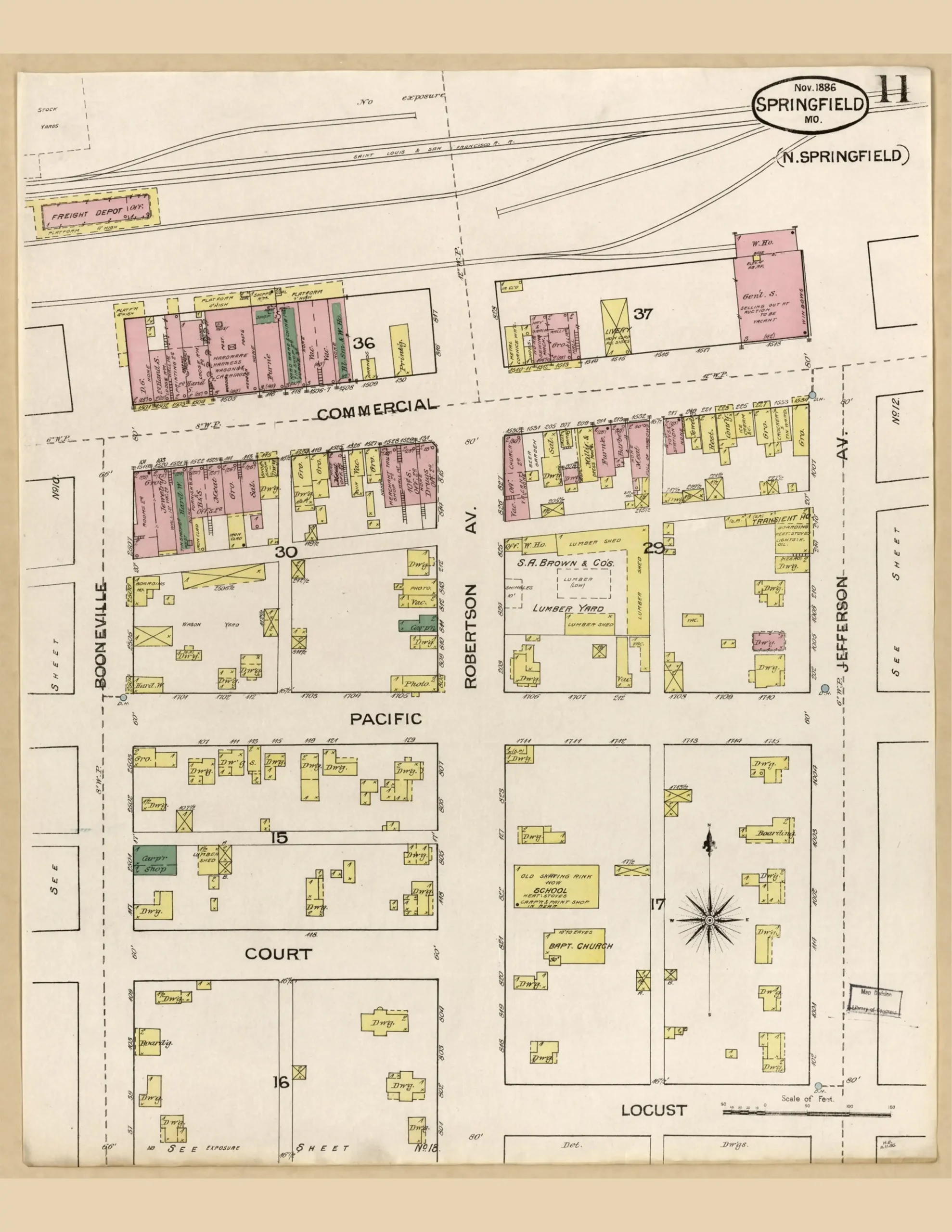
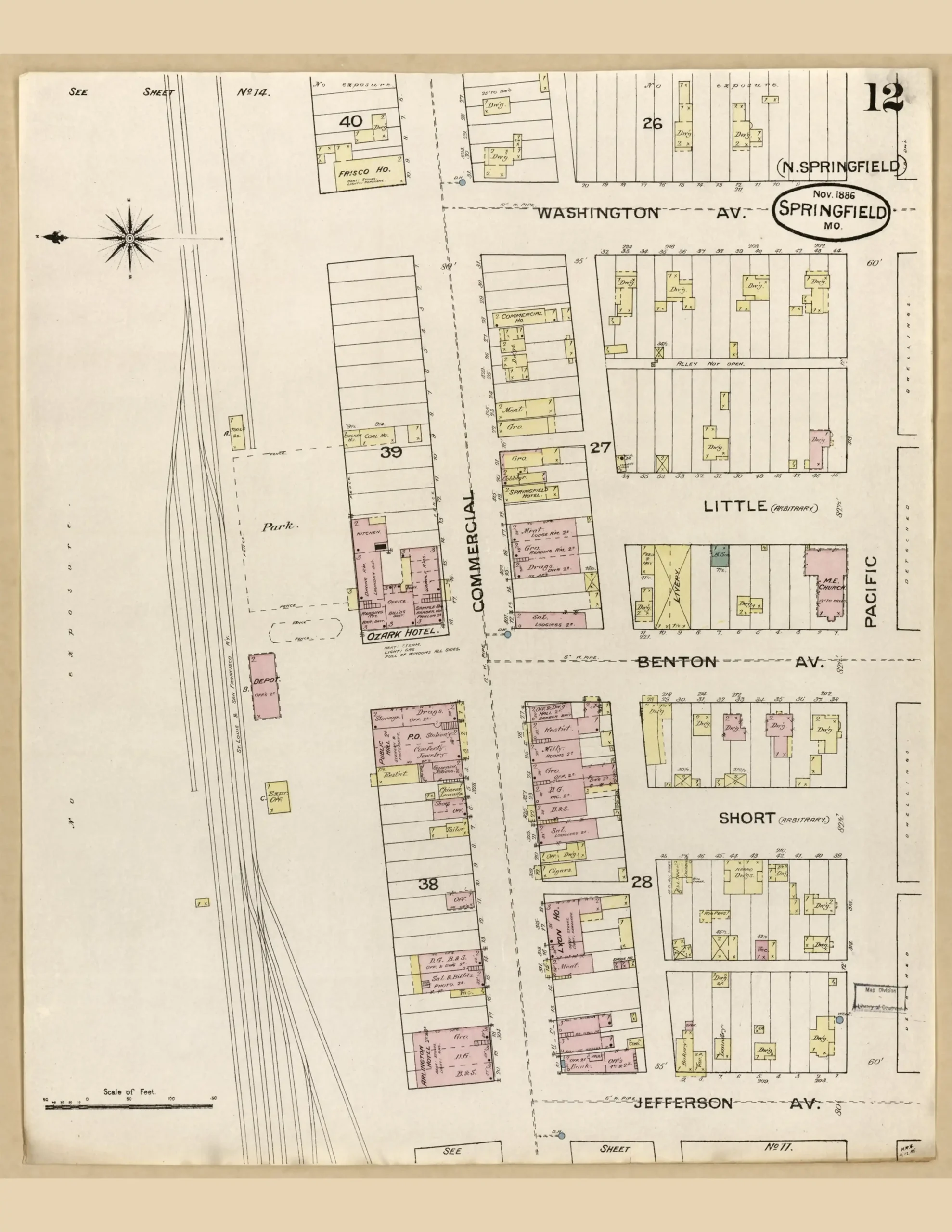
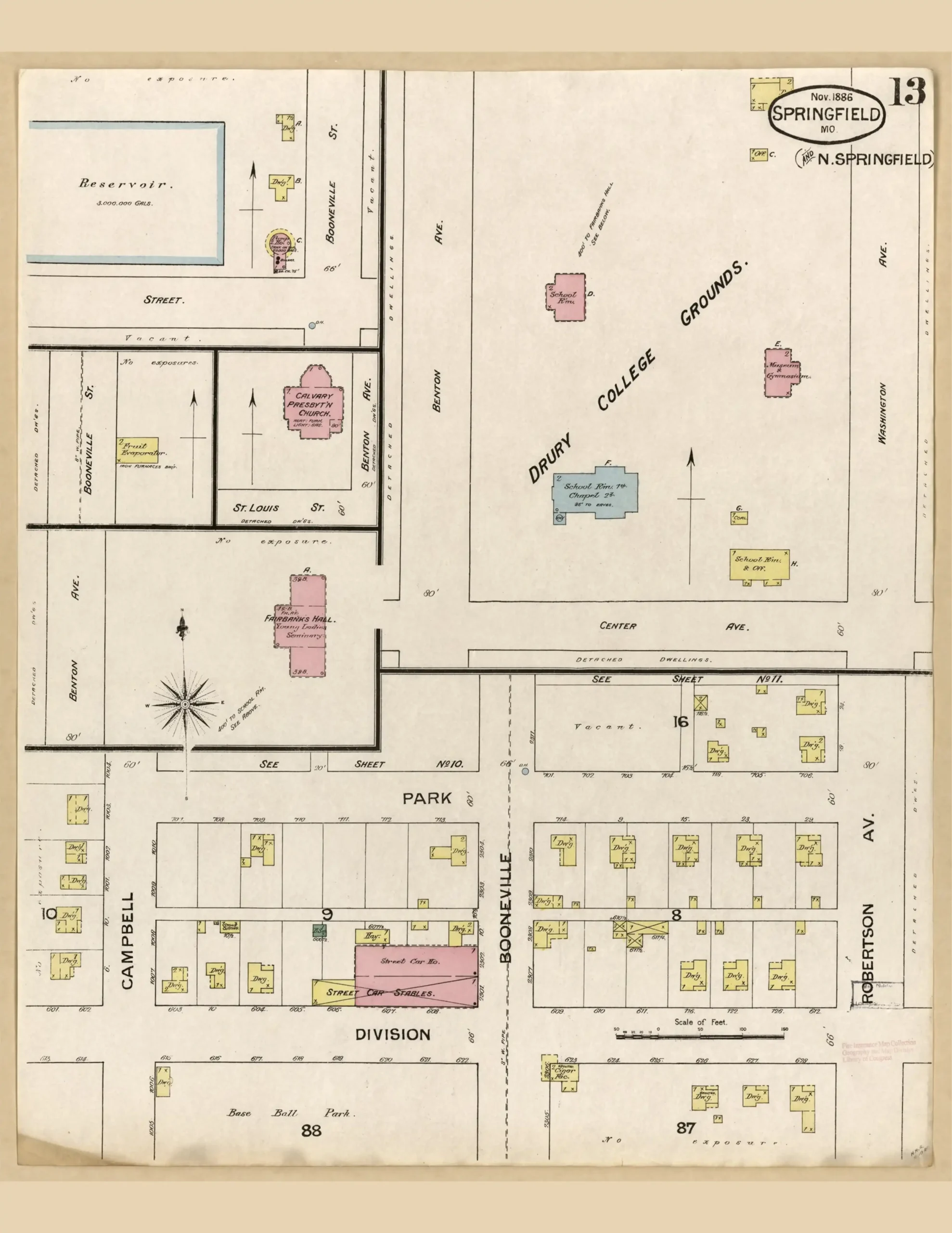
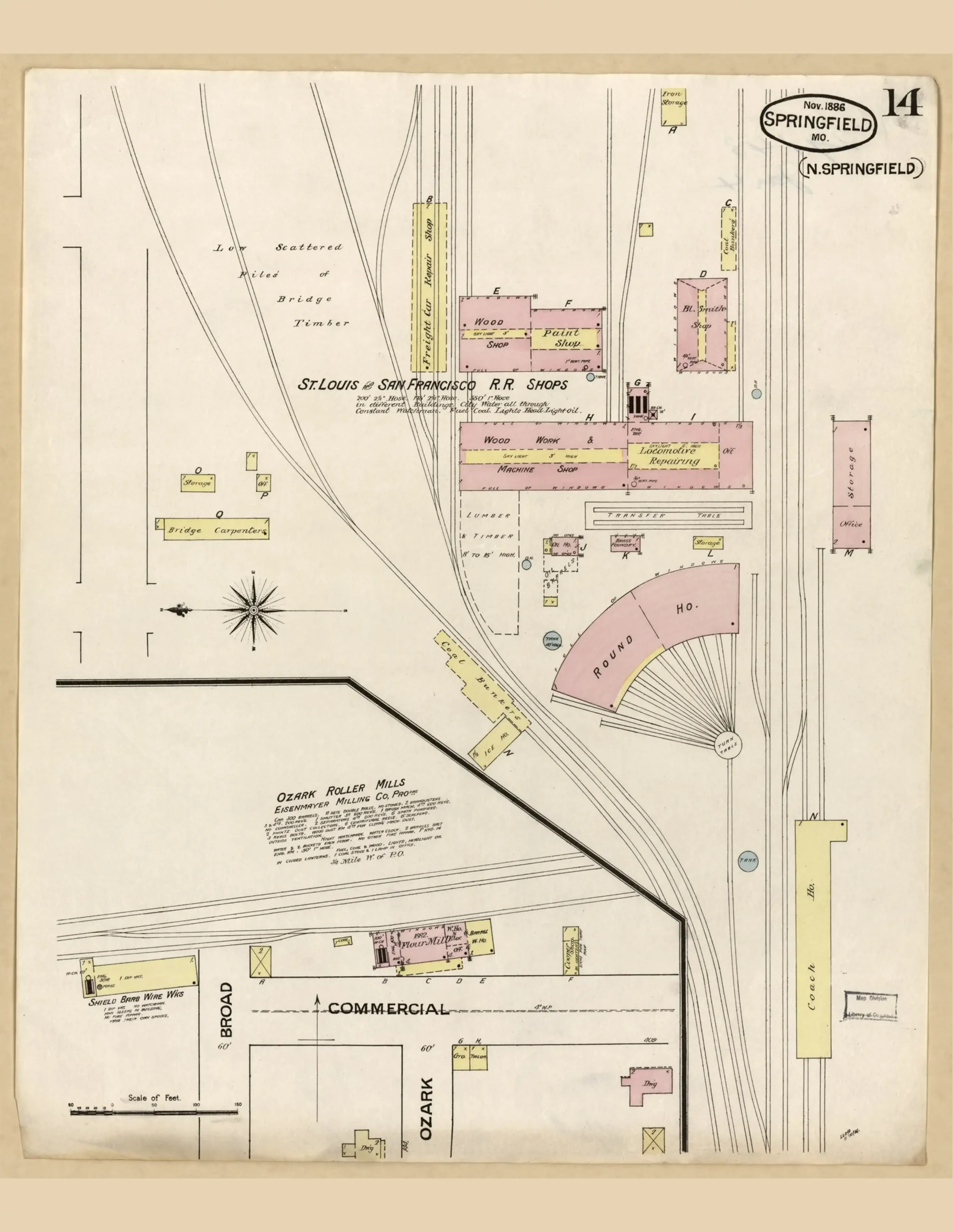
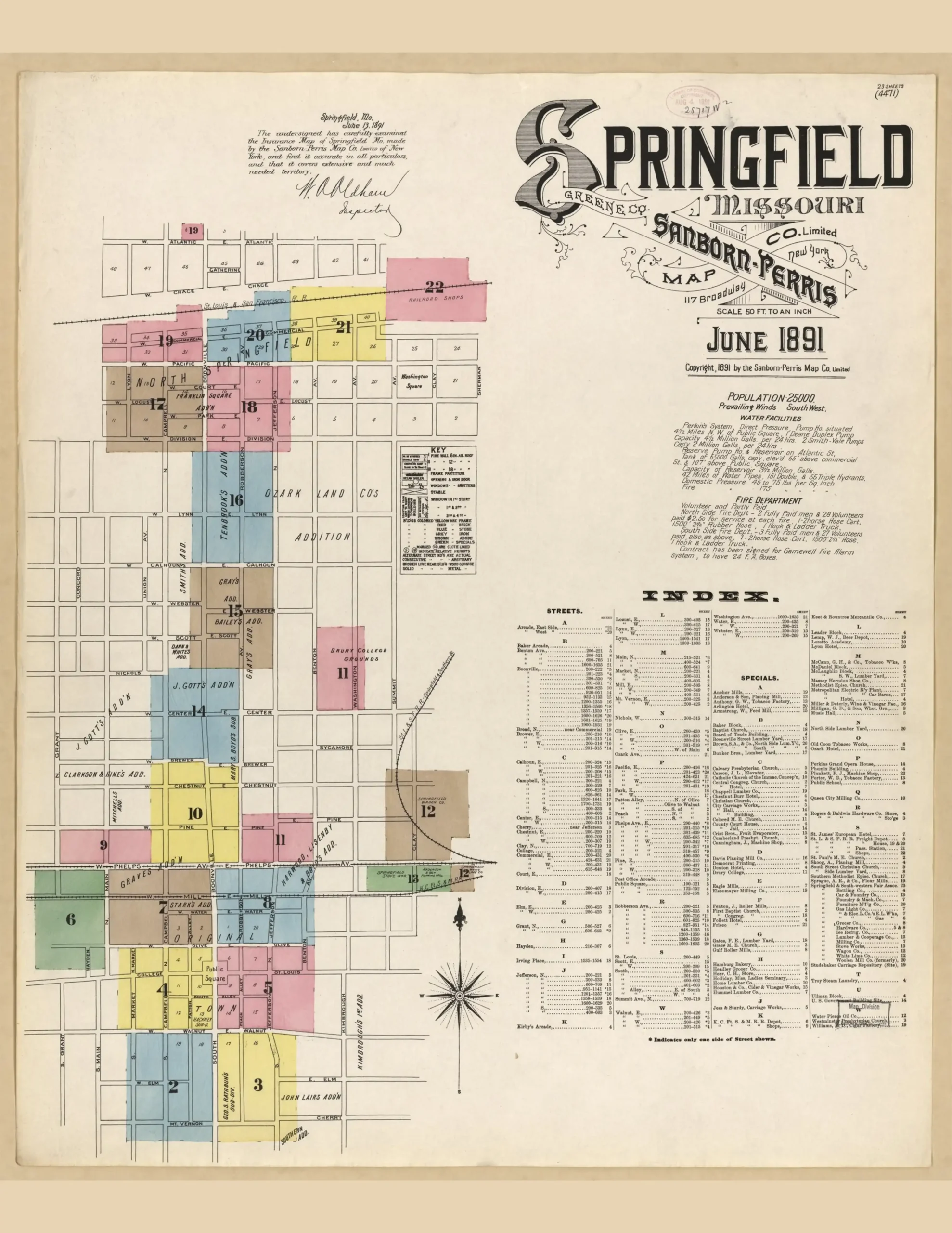
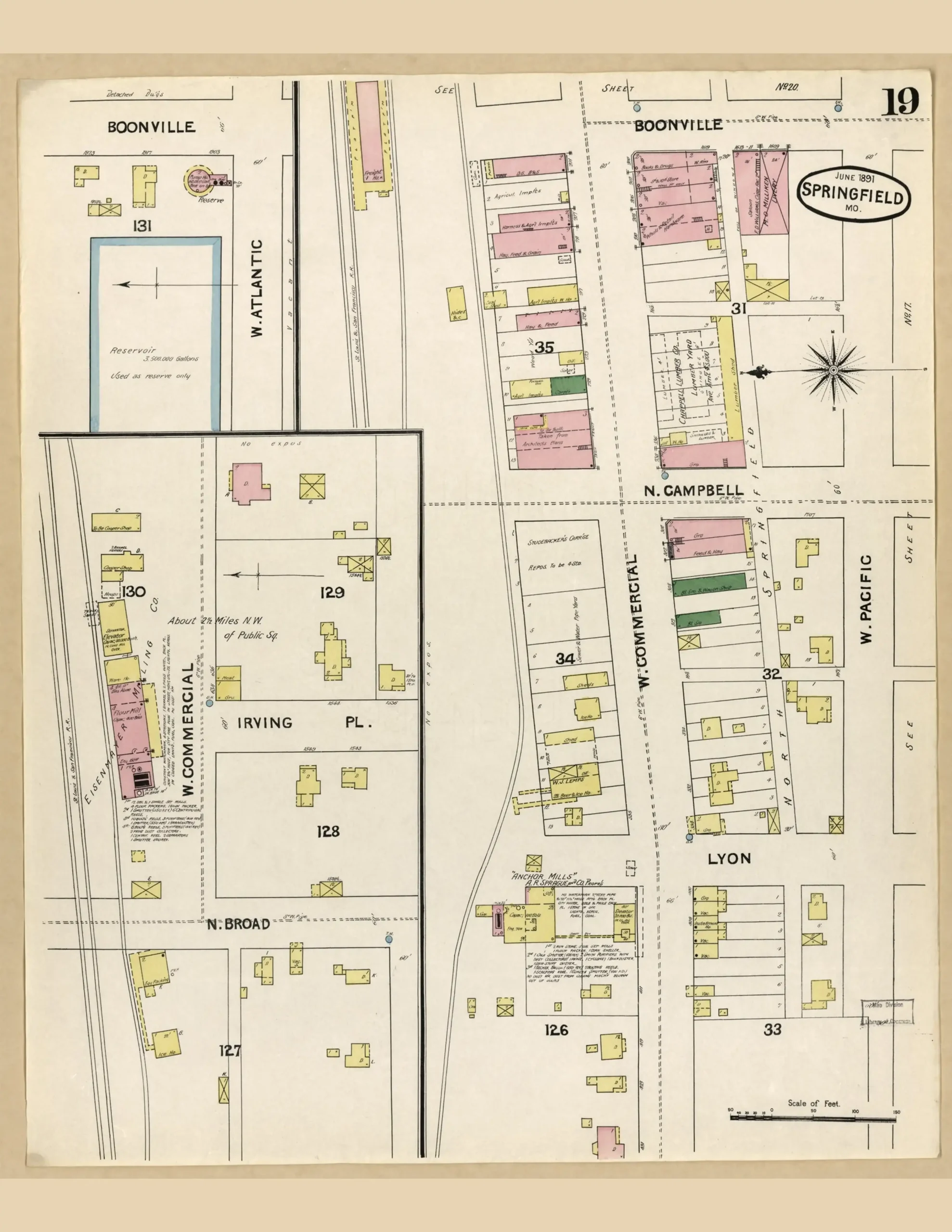
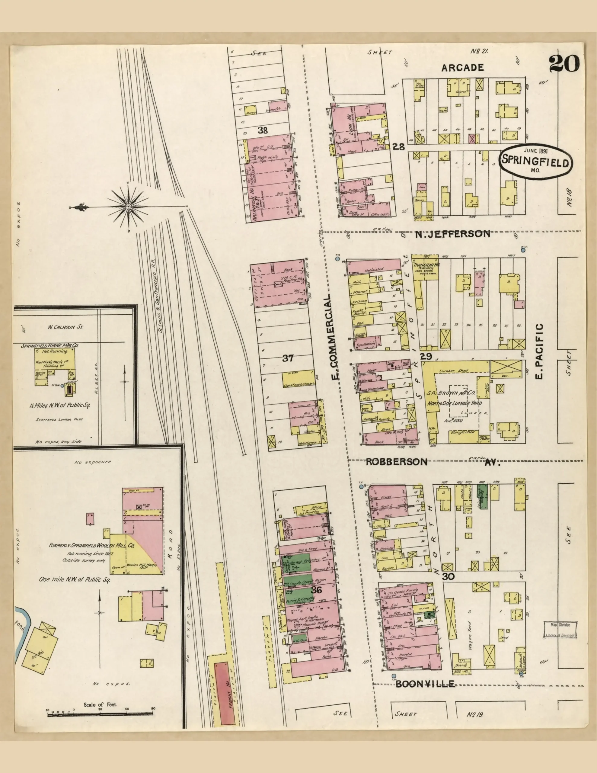
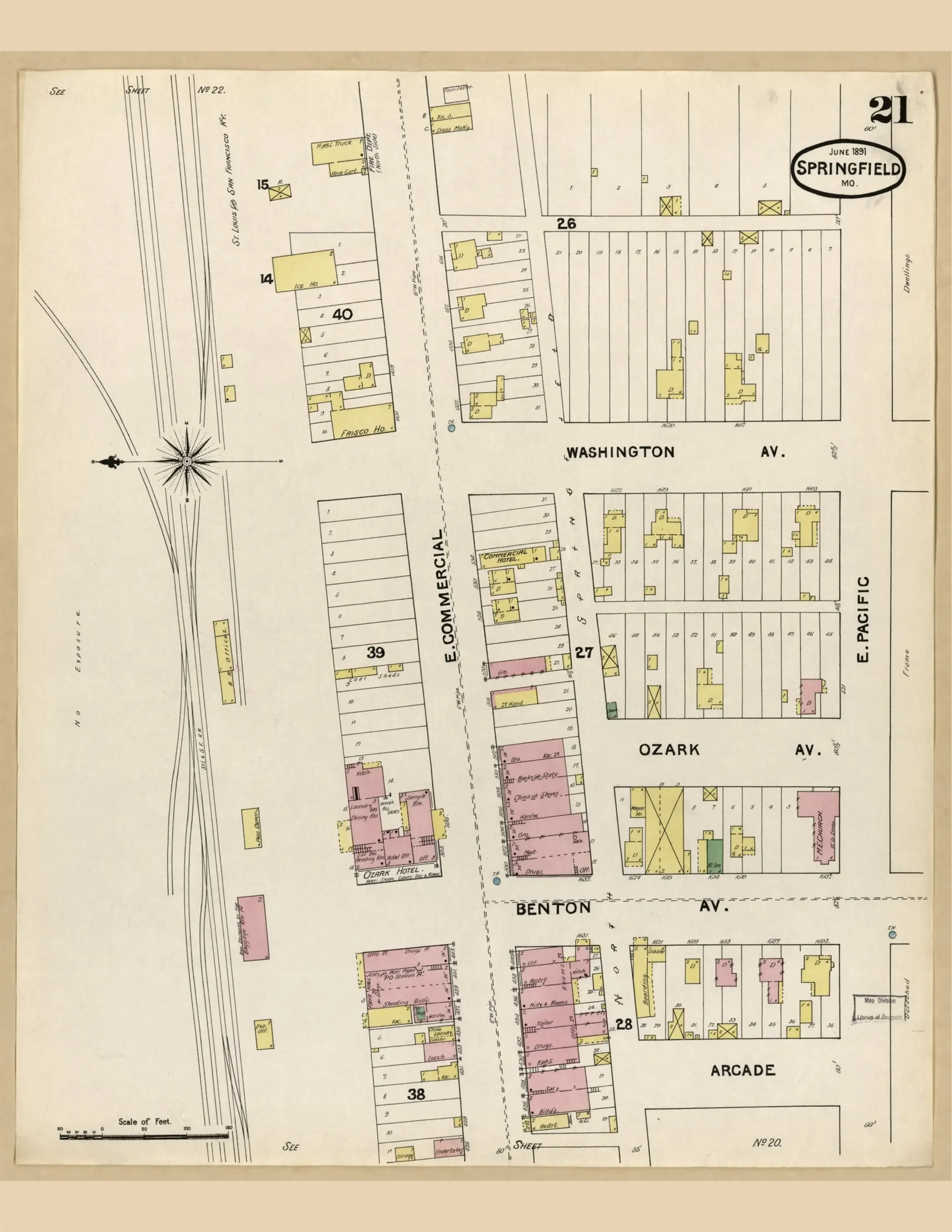
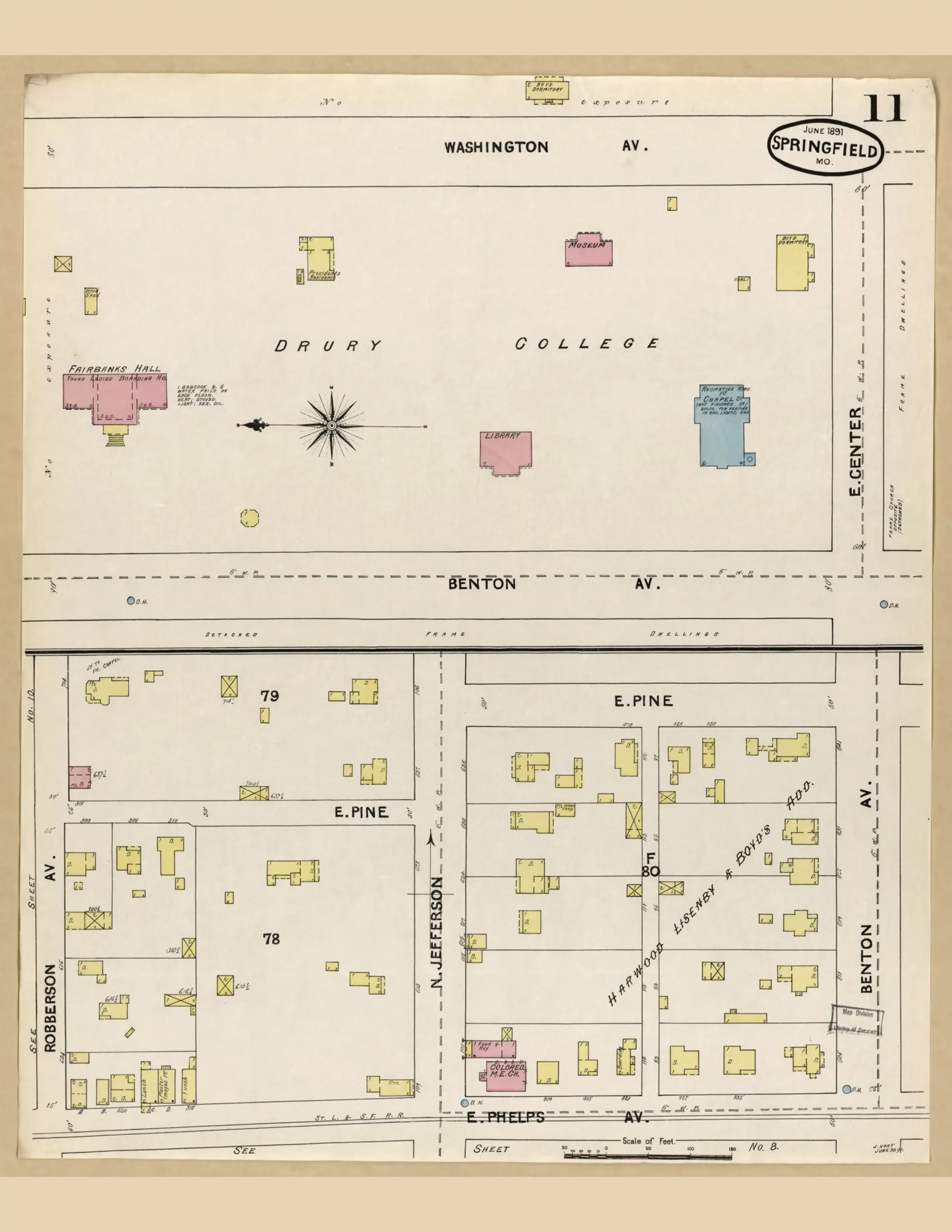
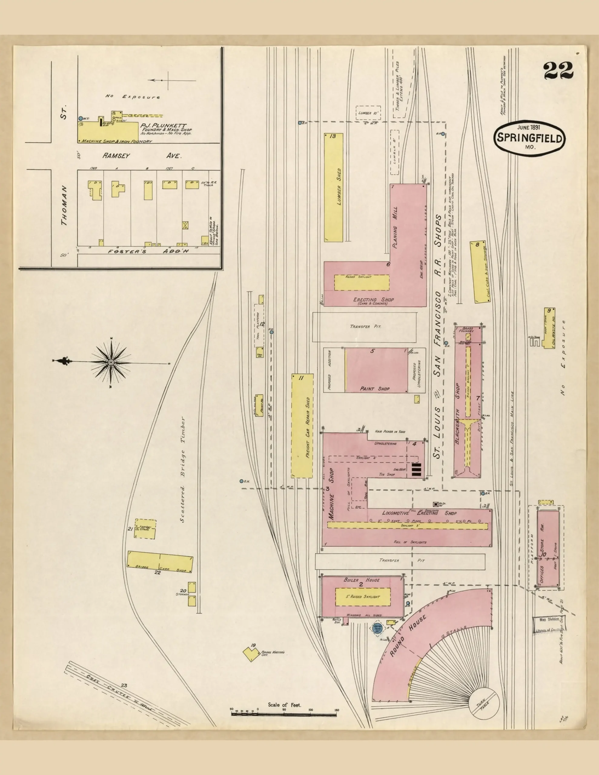
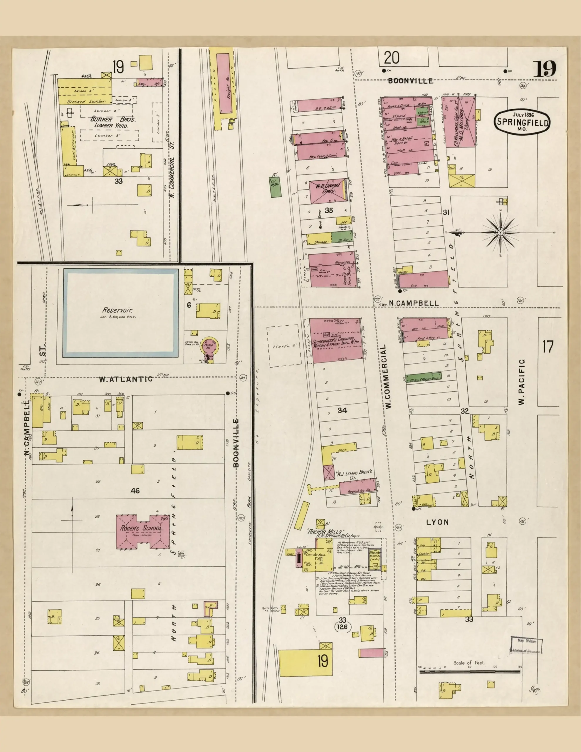
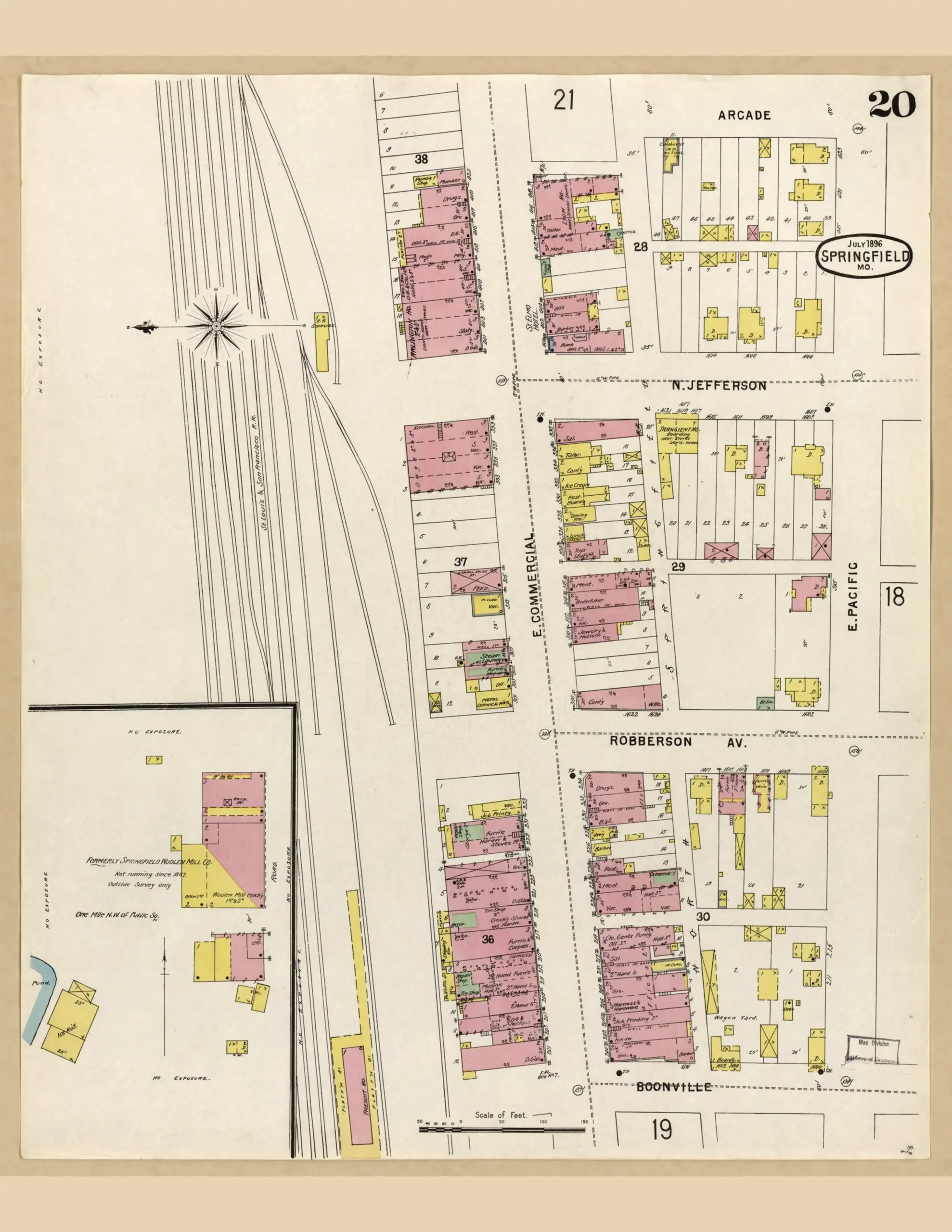
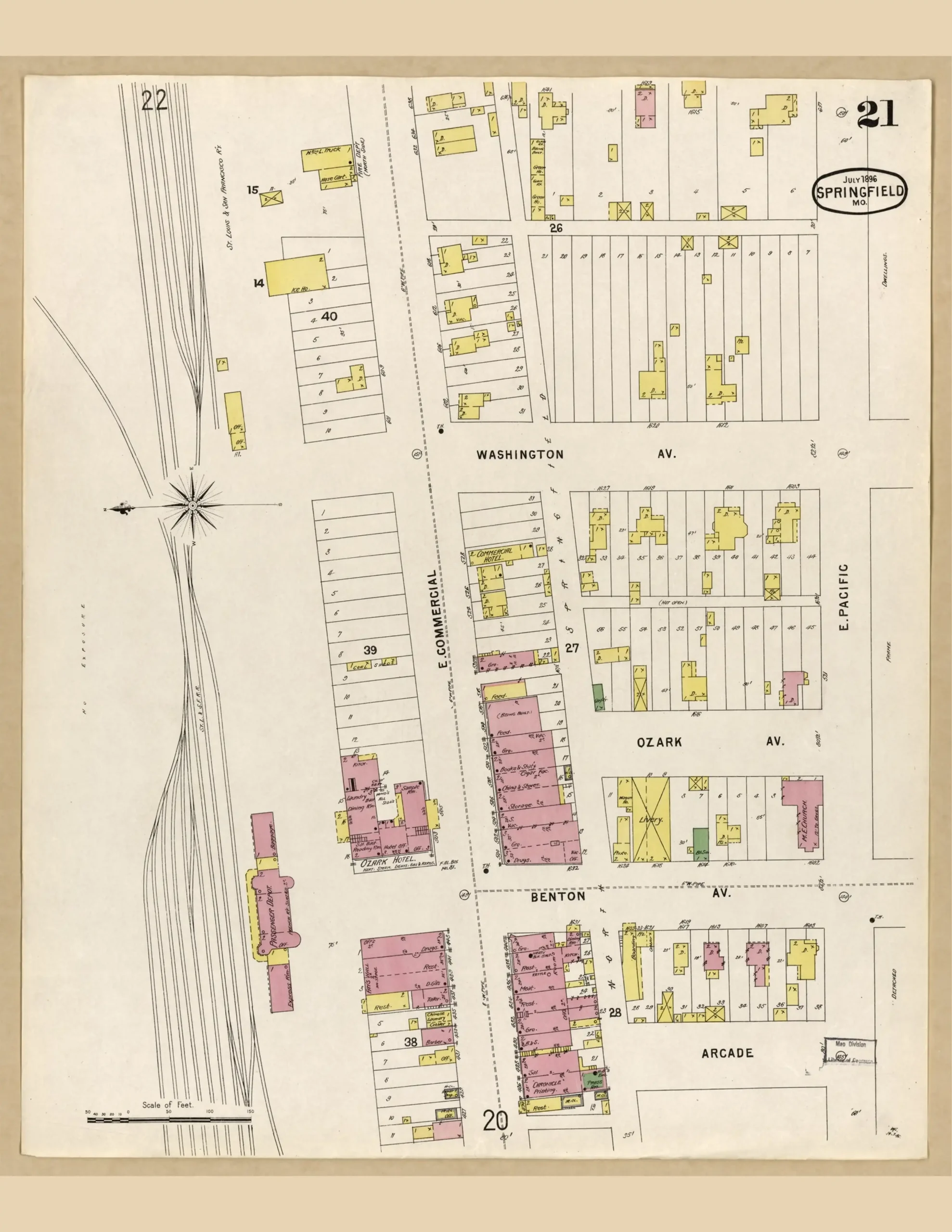
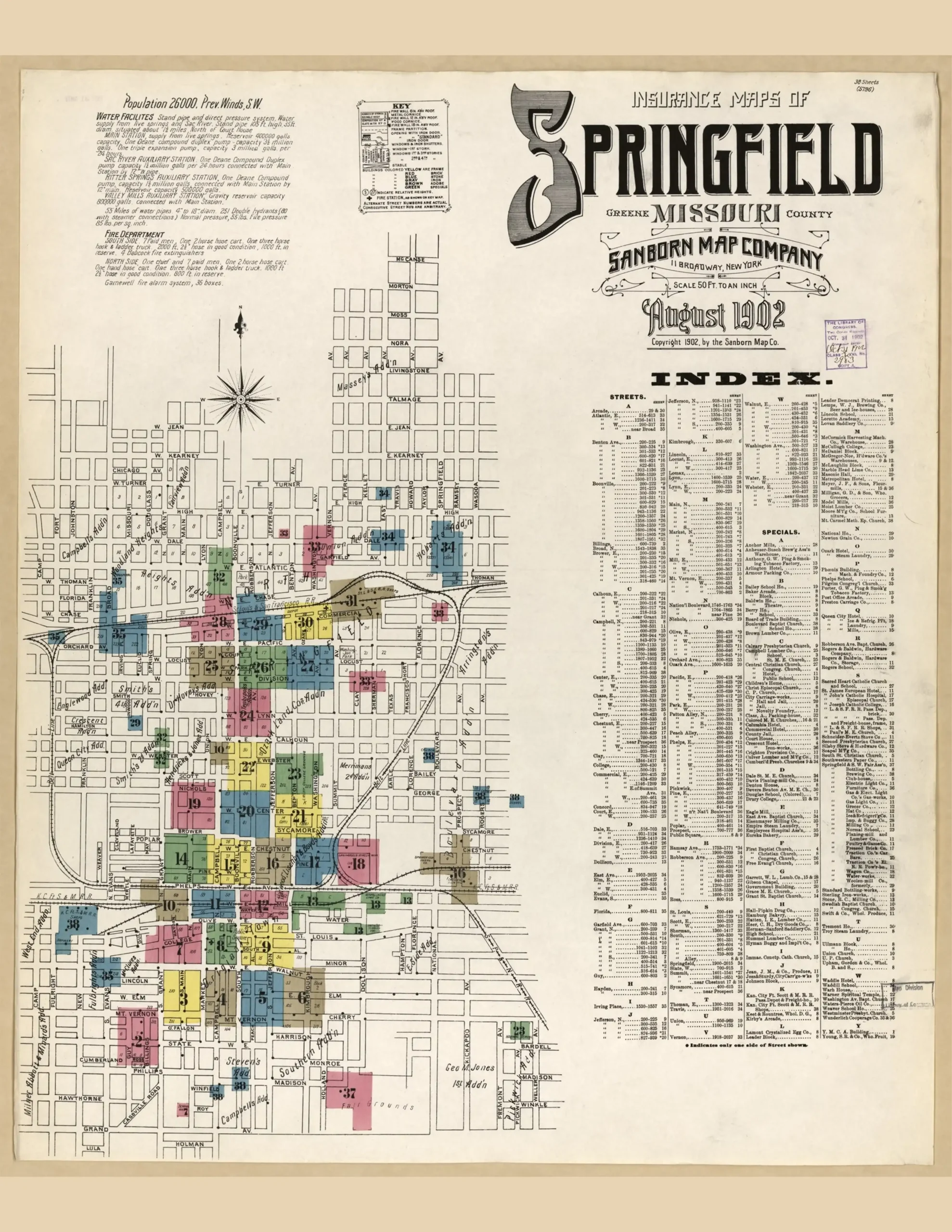
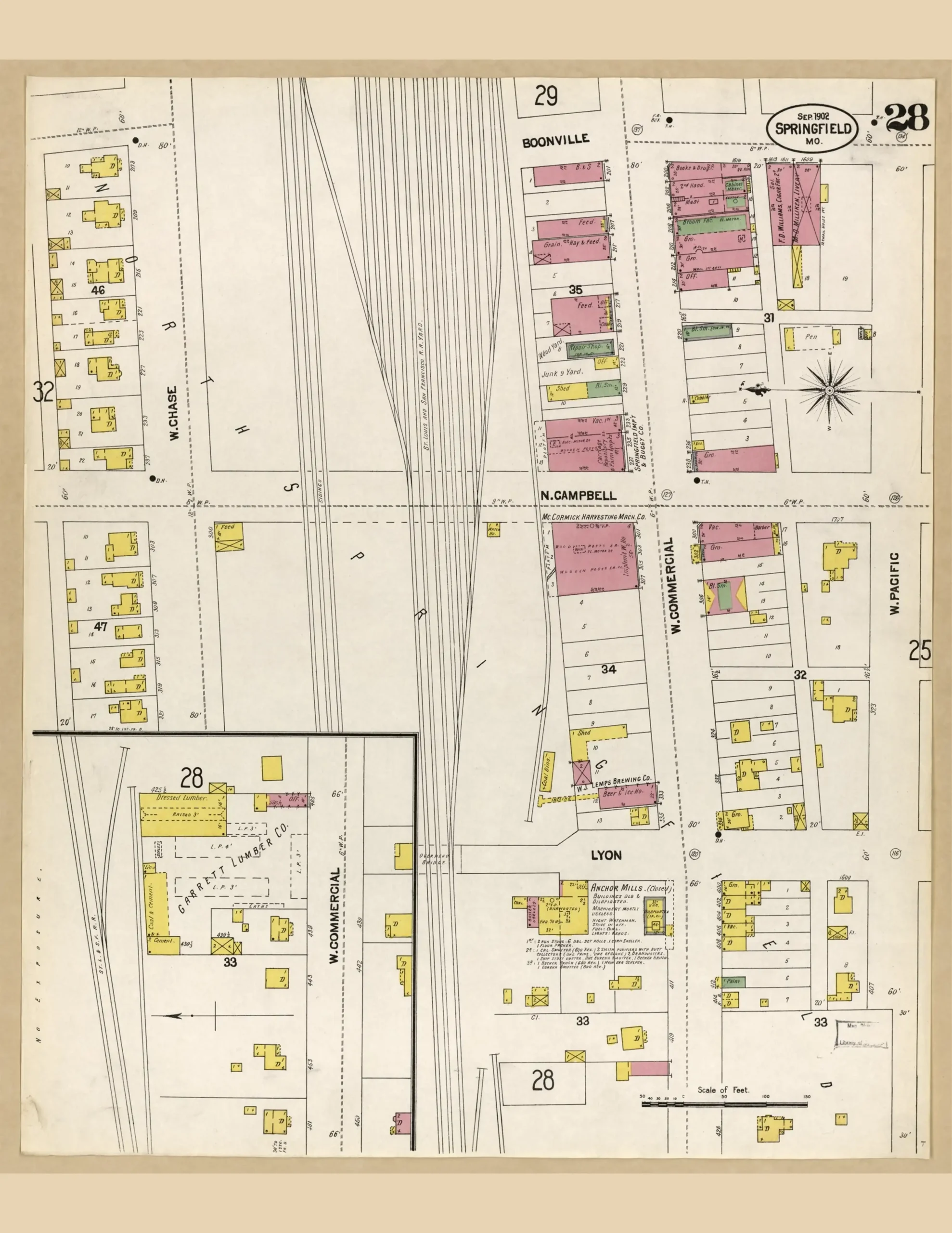
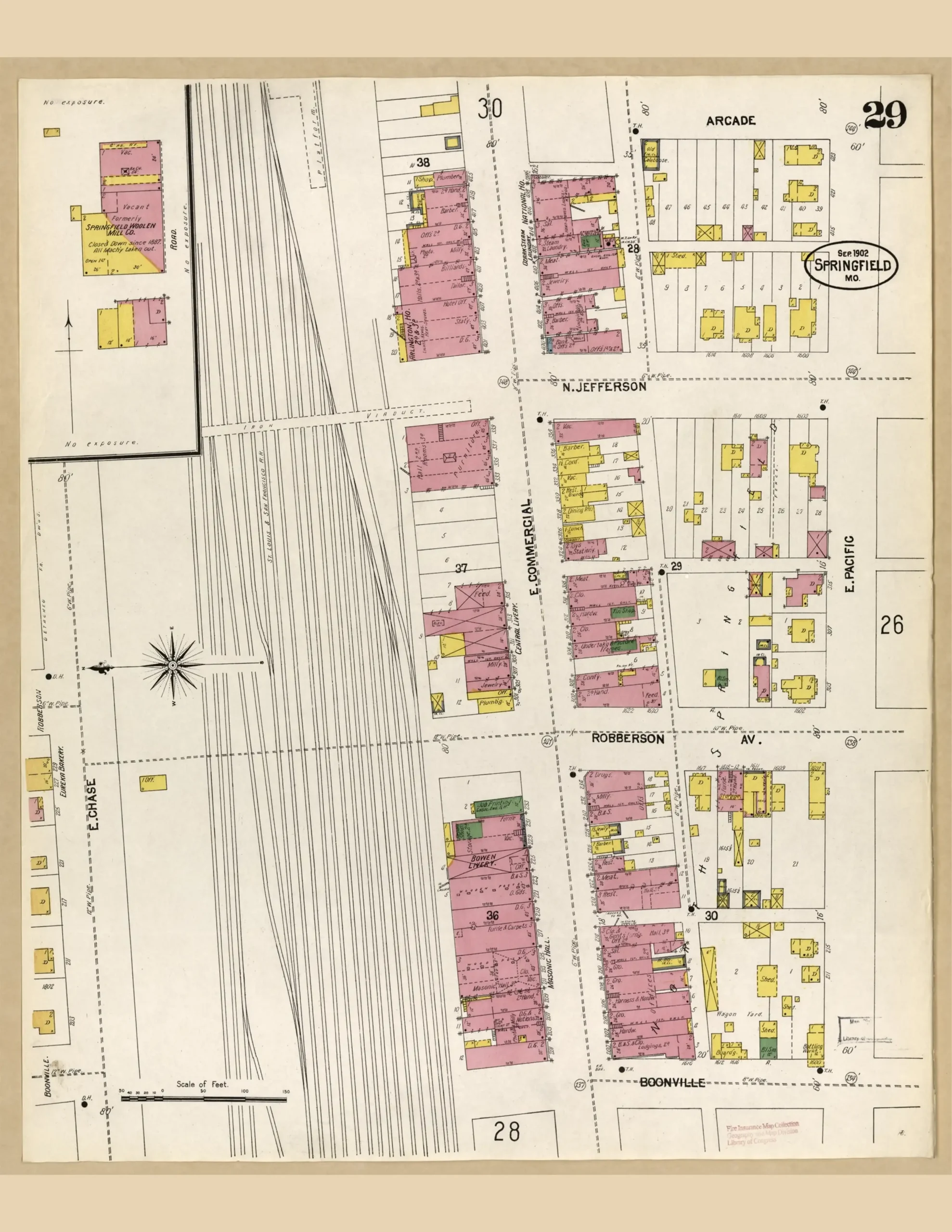
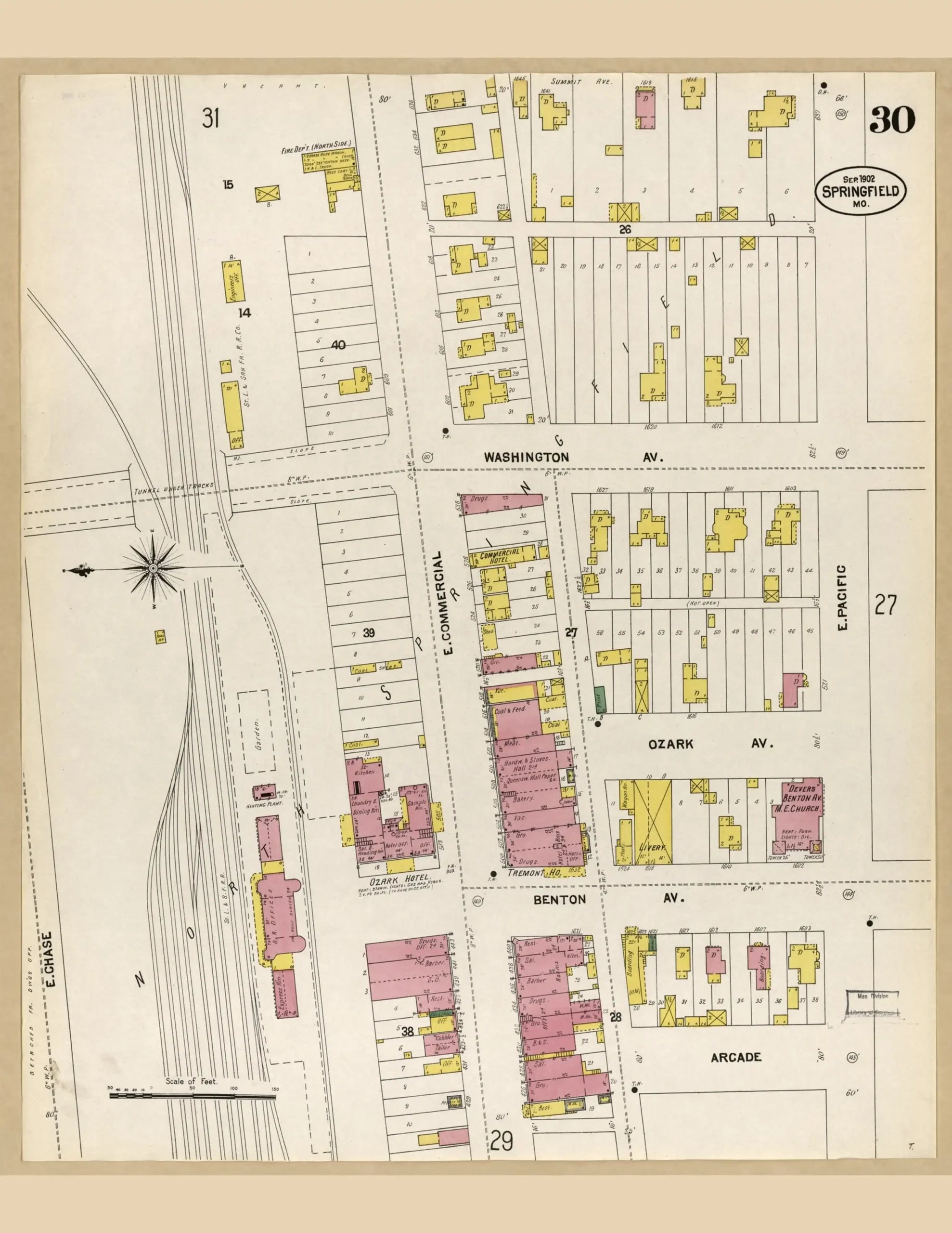
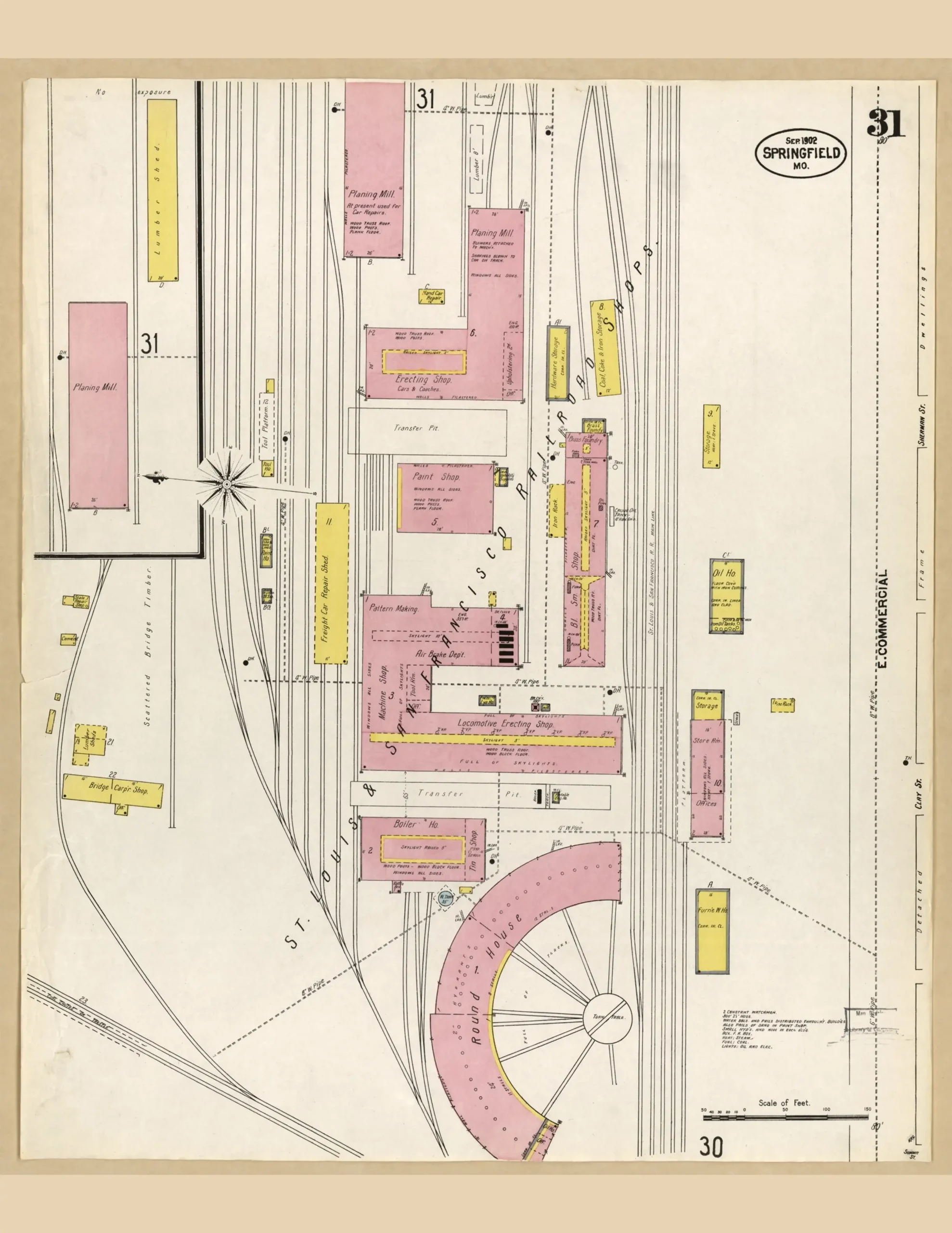
Sanborn maps were drawn for fire insurance underwriters, so they record what an underwriter needed to know: each building’s footprint, how many stories it stood, what it was built of, and what went on inside. Color carries meaning. Pink marks brick, yellow marks frame, blue marks stone or concrete. Read in sequence, these five surveys show Commercial Street filling in block by block across eighteen years, and the railroad shops that paid for it all growing alongside.
The sheets are arranged west to east, then the rail yards, then south, following the street as a visitor would walk it. This archive holds twenty-three sheets. The 1896 survey is partial: its index and rail yards sheets were never located, so 1896 is shown by three sheets rather than five.
Courtesy of the Library of Congress. Click any image to open the full map.